
The prediction of natural disasters is a complex and critical endeavor that involves a combination of advanced technologies, scientific methodologies, and continuous monitoring. Scientists utilize a variety of tools such as satellite data, seismic monitoring, and weather pattern analysis to foresee events like hurricanes, earthquakes, and tsunamis. However, despite significant progress in predictive capabilities, uncertainties and challenges persist in accurately forecasting certain catastrophic events. To delve into the intricate mechanisms and evolving strategies employed in the prediction of natural disasters, one must consider the interdisciplinary nature of this scientific pursuit and the ongoing quest for enhancing predictive accuracy and timeliness.
Key Takeaways
- Historical data analysis informs predictive models and enhances accuracy.
- Seismic activity monitoring aids in earthquake prediction and damage assessment.
- Advanced technology and machine learning improve early warning systems.
- Communication strategies and alert systems enhance disaster preparedness and response.
Historical Data Analysis
In the realm of predicting natural disasters, a foundational aspect lies in the meticulous examination and analysis of historical data pertaining to past catastrophic events. Historical data analysis plays a crucial role in disaster management by offering insights into the patterns and trends of previous natural disasters. By scrutinizing data points such as location, magnitude, frequency, and impact of past events, scientists can identify correlations and potential future occurrences. This analysis enables the creation of models and algorithms that forecast the likelihood and intensity of future disasters with greater accuracy.
Moreover, trends observed in historical data aid in the development of early warning systems and preparedness strategies for communities vulnerable to specific types of disasters. Through the study of historical data, researchers can continuously refine and enhance the predictive capabilities for various natural disaster scenarios. Ultimately, the analysis of historical data is instrumental in improving the effectiveness of disaster management practices and increasing the overall resilience of communities facing potential natural disasters.
Seismic Activity Monitoring
Drawing a direct link from the foundational analysis of historical data to the contemporary realm of disaster prediction, seismic activity monitoring emerges as a critical component in understanding and preparing for potential natural disasters. Seismic activity monitoring involves the use of seismometers to track ground vibrations and movements, detecting seismic waves caused by earthquakes and volcanic eruptions. By analyzing seismic data, scientists can gain insights into fault lines, tectonic plate movements, and potential earthquake risks. This data is essential for predicting earthquakes, determining their magnitude, and assessing potential damage. Continuous monitoring of seismic activity enables the issuance of timely warnings and the implementation of safety measures in earthquake-prone regions. Understanding the patterns of earthquake and aftershock sequences through monitoring and forecasting seismic activity plays a crucial role in disaster preparedness and mitigation efforts. Through the diligent observation and analysis of seismic data, scientists can work towards reducing the impact of earthquakes on vulnerable populations.
Weather Pattern Observation

Utilizing advanced technology and analytical methods, meteorologists meticulously observe and analyze weather patterns to forecast upcoming atmospheric conditions accurately. Various tools such as satellites, radars, and ground-based sensors are employed to track key atmospheric parameters like temperature, humidity, air pressure, and wind patterns. Doppler radar technology plays a crucial role in monitoring precipitation, storm movement, and identifying severe weather conditions. By observing cloud formations, air masses, and pressure systems, meteorologists can predict the occurrence of natural hazards such as hurricanes, tornadoes, and thunderstorms. Additionally, the use of AI systems enhances the analysis of vast amounts of data, improving the accuracy of weather predictions. Historical weather data is also compared with current observations to identify trends and patterns that aid in making precise forecasts about future weather events.
| Weather Observation Methods | Applications |
|---|---|
| Satellites | Tracking weather patterns and natural hazards |
| Radars | Monitoring precipitation and storm movement |
| Ground-based Sensors | Measuring temperature, humidity, and air pressure |
| Doppler Radar Technology | Identifying severe weather conditions |
| AI Systems | Enhancing data analysis for accurate predictions |
Satellite Imaging Technology
Satellite imaging technology is a critical tool in disaster prediction and monitoring due to its ability to collect real-time data and provide high-resolution images of Earth's surface. By analyzing these images, scientists can track weather patterns, assess damages caused by natural disasters, and plan effective response strategies. The use of satellite imaging technology enhances early warning systems and improves disaster management by offering valuable insights into the dynamics of natural events.
Satellite Data Collection
Employing advanced technology to capture comprehensive data on Earth's surface and atmosphere, satellite imaging plays a crucial role in monitoring and predicting natural disasters. Satellite data collection involves satellites orbiting the Earth and capturing vital information on weather patterns, land use, vegetation, and potential natural disasters such as hurricanes, floods, wildfires, and earthquakes. This data is instrumental in early warning systems and disaster response planning, enabling authorities to prepare and respond effectively. By providing real-time monitoring and assessment of natural disaster impacts, satellite imaging technology enhances our ability to predict these events and mitigate their consequences. The continuous collection and analysis of satellite data are essential for improving our understanding of natural disasters and enhancing disaster preparedness strategies.
Weather Pattern Analysis
How can satellite imaging technology revolutionize the analysis of weather patterns for enhanced prediction and monitoring of natural disasters? Satellite imaging technology, coupled with AI algorithms, plays a crucial role in predicting natural disasters by analyzing weather patterns. Here's how it aids in this process:
- Real-Time Data: High-resolution satellite images offer up-to-the-minute information on weather conditions, aiding in accurate forecasts.
- Storm Tracking: Scientists utilize satellite technology to monitor storm formations, cloud movements, and atmospheric disturbances, enabling early detection of potential disasters.
- Disaster Identification: Satellite imaging helps in recognizing signs of impending natural disasters like hurricanes, tornadoes, and severe storms.
- Enhanced Monitoring: Advanced satellite systems improve the ability to monitor and forecast natural disasters with precision.
Early Warning Systems
Early warning systems play a crucial role in predicting and mitigating the impact of natural disasters. Sensor technologies provide essential data for analysis, enabling the timely detection of potential threats. Effective communication and alerts based on these systems are instrumental in facilitating preparedness and response measures to safeguard lives and properties.
Sensor Technology Role
Sensor technology is integral to the functioning of early warning systems for natural disasters.
- Sensors detect changes in the environment such as seismic activity, temperature variations, and atmospheric pressure.
- The data collected by sensors is utilized for analyzing patterns and trends to provide timely warnings to communities at risk.
- Early warning systems heavily depend on sensor technology to monitor and predict events like earthquakes, floods, and hurricanes.
- Continuous advancements in sensor technology contribute to enhancing the accuracy and timeliness of natural disaster predictions.
Data Analysis Techniques
The efficacy of early warning systems in predicting natural disasters hinges significantly on the sophisticated data analysis techniques employed to interpret various environmental indicators. By utilizing advanced AI algorithms, vast amounts of data collected from seismic activities, satellite imagery, and historical patterns are processed to forecast earthquakes, hurricanes, tornadoes, and volcanic eruptions accurately. These data analysis methods enable the integration of climate change data, further enhancing the precision of predictions within early warning systems. Through the systematic analysis of real-time data and the application of cutting-edge technology, early warning systems can provide crucial alerts and help mitigate the impacts of natural disasters on vulnerable populations and infrastructure.
Communication and Alerts
Communication channels play a pivotal role in disseminating timely alerts and warnings within the framework of early warning systems for natural disasters.
- Various communication channels, including sirens, text alerts, and social media, are employed to notify the public about impending disasters.
- Effective communication facilitates community preparedness and evacuation, thereby reducing casualties and property damage.
- Warning dissemination networks utilize advanced technologies such as mobile apps and weather radios to reach a broad audience.
- Tailoring warning messages to specific demographics and geographical areas enhances response rates and preparedness for disasters.
Collaborative efforts among government agencies, meteorological organizations, and local authorities further enhance the effectiveness of early warning systems in predicting and communicating natural disasters.
Machine Learning Algorithms
Utilizing sophisticated computational methods, machine learning algorithms play a pivotal role in analyzing historical data to discern patterns and trends associated with natural disaster occurrences. These algorithms leverage various features such as seismic activity, weather patterns, and geographical data to predict the likelihood of future disasters. By training on extensive datasets, machine learning models can classify and forecast different types of natural disasters, aiding in preparedness and mitigation efforts.
Advanced machine learning techniques, including deep learning, further enhance prediction accuracy by identifying intricate relationships within the data. Through ongoing research and development, machine learning algorithms continuously evolve, improving their predictive capabilities. The ability of these algorithms to predict the occurrence of natural disasters provides emergency responders, policymakers, and communities with valuable insights for better understanding and planning for such events. By harnessing the power of machine learning, we can enhance our preparedness and response strategies to mitigate the impact of natural disasters.
Tsunami Detection Methods
Detection methods for tsunamis rely on a combination of deep-ocean sensors, seismic networks, and buoy systems to monitor and forecast potential wave activity.
Tsunami Detection Methods:
- Deep-Ocean Sensors: These instruments measure changes in water pressure, allowing for the detection of tsunami waves as they travel through the ocean.
- Seismic Networks: By monitoring earthquake activity, seismic networks can provide early warnings of potential tsunamis triggered by undersea seismic events.
- Buoy Systems: Positioned in the ocean, buoy systems can detect the passage of tsunami waves and transmit real-time data to tsunami warning centers for swift action.
- Tsunami Warning Systems: These systems integrate information from various sources, including deep-ocean sensors, seismic networks, and buoy data, to accurately predict tsunami arrival times and issue timely alerts to at-risk populations.
Volcanic Activity Forecasting
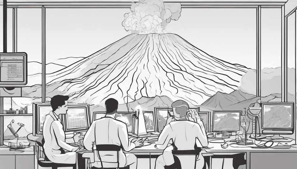
Volcanic activity forecasting plays a crucial role in monitoring and predicting potential eruptions through the analysis of seismic data and advanced technological tools. By closely monitoring seismic data, scientists can detect early warning signs of impending volcanic eruptions. Utilizing tools such as satellite imagery and ground deformation sensors, researchers track changes in gas emissions, ground temperature, and seismicity, which are vital indicators for predicting volcanic activity. These observations are integrated into volcanic forecasting models, combining multiple data sources to enhance the accuracy of eruption predictions.
Early detection and forecasting of volcanic activity are essential for issuing timely warnings and implementing evacuation plans to mitigate risks and save lives. Through continuous monitoring and analysis, scientists strive to improve the effectiveness of volcanic activity forecasting, ultimately contributing to better disaster preparedness and response strategies. By understanding the mechanisms behind volcanic eruptions and leveraging technological advancements, researchers can work towards minimizing the impact of these natural disasters on vulnerable populations.
Frequently Asked Questions
What Technology Predicts Natural Disasters?
Various technologies contribute to the prediction of natural disasters. Satellite imaging aids in monitoring weather patterns and identifying potential hazards. Seismic monitoring systems analyze ground movements to predict earthquakes. Advanced weather forecasting models utilize data from satellites and ground stations to predict storms, hurricanes, and floods. These technologies, when combined with artificial intelligence and machine learning algorithms, enhance the accuracy and timeliness of predicting natural disasters for early warning and preparedness.
What Natural Hazards Are Predictable?
Hurricane tracking, earthquake forecasting, flood modeling, landslide prediction, tsunami early warning, and volcano monitoring are some natural hazards that can be predicted. Through the analysis of seismic data, satellite imagery, climate data, and historical patterns, scientists predict these disasters. Understanding the predictability of these hazards is crucial for disaster preparedness and response strategies, enabling the implementation of early warning systems and evacuation plans to mitigate risks effectively.
How Do You Know When a Natural Disaster Is Coming?
Recognizing impending natural disasters involves vigilance for specific signs. Early warning systems, incorporating seismic, meteorological, and hydrological data, play a crucial role. Watch for anomalous seismic activity, unusual weather patterns, rising water levels, or gas emissions near volcanoes. These signs trigger emergency response measures, including evacuations and readiness protocols. Early detection and swift action can mitigate the impact of natural disasters, safeguarding lives and property.
What Is the Instrument Used to Predict Natural Disasters?
Seismic sensors are instrumental in predicting earthquakes, providing critical data on ground motion. Weather satellites play a key role in forecasting severe weather events, such as tornadoes and hurricanes, enabling early warning systems. These instruments, along with others like tiltmeters for monitoring ground deformation, are essential tools in predicting natural disasters. By harnessing technology and data analysis, scientists can better anticipate and prepare for potential catastrophic events.
Conclusion
In conclusion, the intricate web of scientific methodologies and advanced technologies utilized to predict natural disasters serves as a beacon of hope amidst the chaos of impending calamity. Like a vigilant sentinel, these systems stand guard, deciphering the cryptic messages of nature to offer timely warnings and mitigate catastrophic consequences. Through the relentless pursuit of knowledge and innovation, we strive to shield our communities from the wrath of nature's unforgiving forces.